Plans and Maps
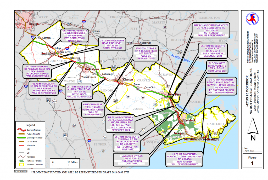
U.S. Highway 70 Project Status Map
for Johnston, Wayne, Lenoir, Jones, Craven and Carteret Counties

U.S. 70 Master Plan Maps Available for Review
The most recent versions of the updated US 70 Master Plan maps are now available for review and comment. The maps below are available for download in 11×17 format including Access Management (short-term) and Conceptual Freeway (long-term) improvements.
The maps display existing and completed projects in red and orange, planned NCDOT projects in green, access management measures in yellow and dark blue, and freeway improvements in magenta and light blue.
|
Maps by |
Access Management |
Conceptual Freeway |
|
Johnston County |
||
| Johnston Co Map Key: 1–Wilson’s Mill, 2–Selma, 3–Pine Level, 4–Princeton | ||
|
Wayne County |
||
| Wayne Co Map Key: 1–Western Wayne, 2–Western Goldsboro, 3–Central Goldsboro, 4–Eastern Goldsboro, 5–Walnut Creek | ||
|
Lenoir County |
||
| Lenoir Co Map Key: 1–La Grange, 2–Falling Creek, 3–Western Kinston, 4–Eastern Kinston, 5–Dover (Lenoir/Jones) | ||
|
Craven County |
||
| Craven Co Map Key: 1–James City, 2–Thurman, 3–Croatan, 4–Havelock | ||
|
Carteret County |
No available map | |
| Carteret Co Map Key: 1–West Newport, 2–East Newport, 3–West Morehead City, 4–East Morehead City | ||
